I spent two summers researching climate change in the Yukon-Kuskokwim Delta, Alaska, informally known as the YKD. The YKD is a vast expanse of Arctic and subarctic tundra in the Southwestern corner of the state. It is also the ancestral and current home of the Yup’ik peoples.
Because of a phenomenon called “polar amplification,” climate change spurs on warming temperatures in the global north much faster than the rest of the world — 2 to 4 times faster, depending on who you ask. As a result, the tundra ecosystems in the YKD are subjected to rapid changes. The implications of these changes on the YKD and the planet at large are not well understood for a couple of reasons. The changes are occurring in real time, which makes them difficult to pin down, and the YKD itself poses many logistical challenges to conducting research. It is cold and dark for much of the year, it is expensive to reach, it is usually rainy and windy, and, at times, it can be dangerous. For all of these reasons, it is understudied. A handful of scientists, including me, sought to fill the gaps in our understanding of this vulnerable place by collecting a variety of data over the summers of 2022 and 2023.
I’d like to acquaint you with the YKD as I experienced it, the research I conducted there, and the implications of climate change on this fragile and beautiful place.
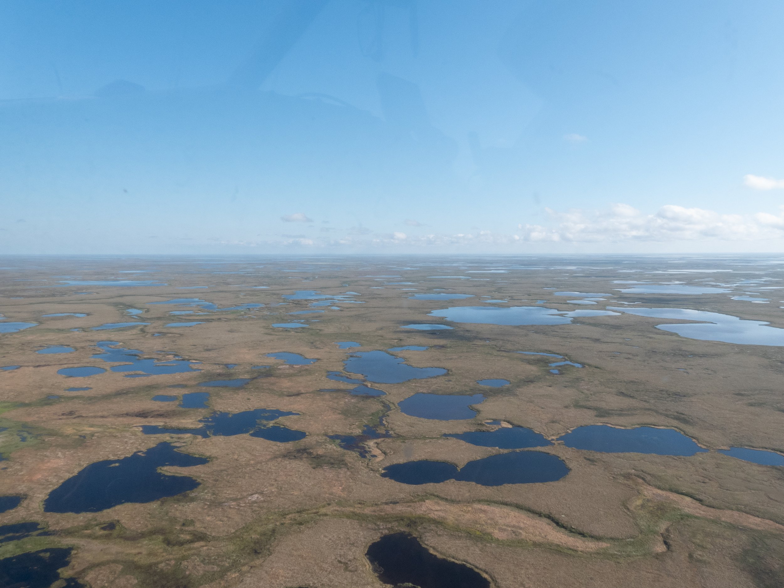
The YKD is a mosaic of land and water that sits roughly 50 - 100 feet above sea level. For the most part, it is flat. The vegetation is usually knee-high or shorter.
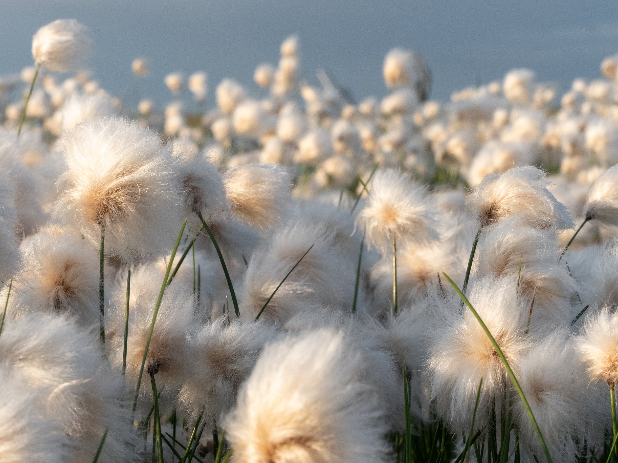
This is cottongrass. There are over 20 species worldwide, but this single-stemmed version (Eriophorum angustifolium) is my favorite. These plants are all over the YKD.
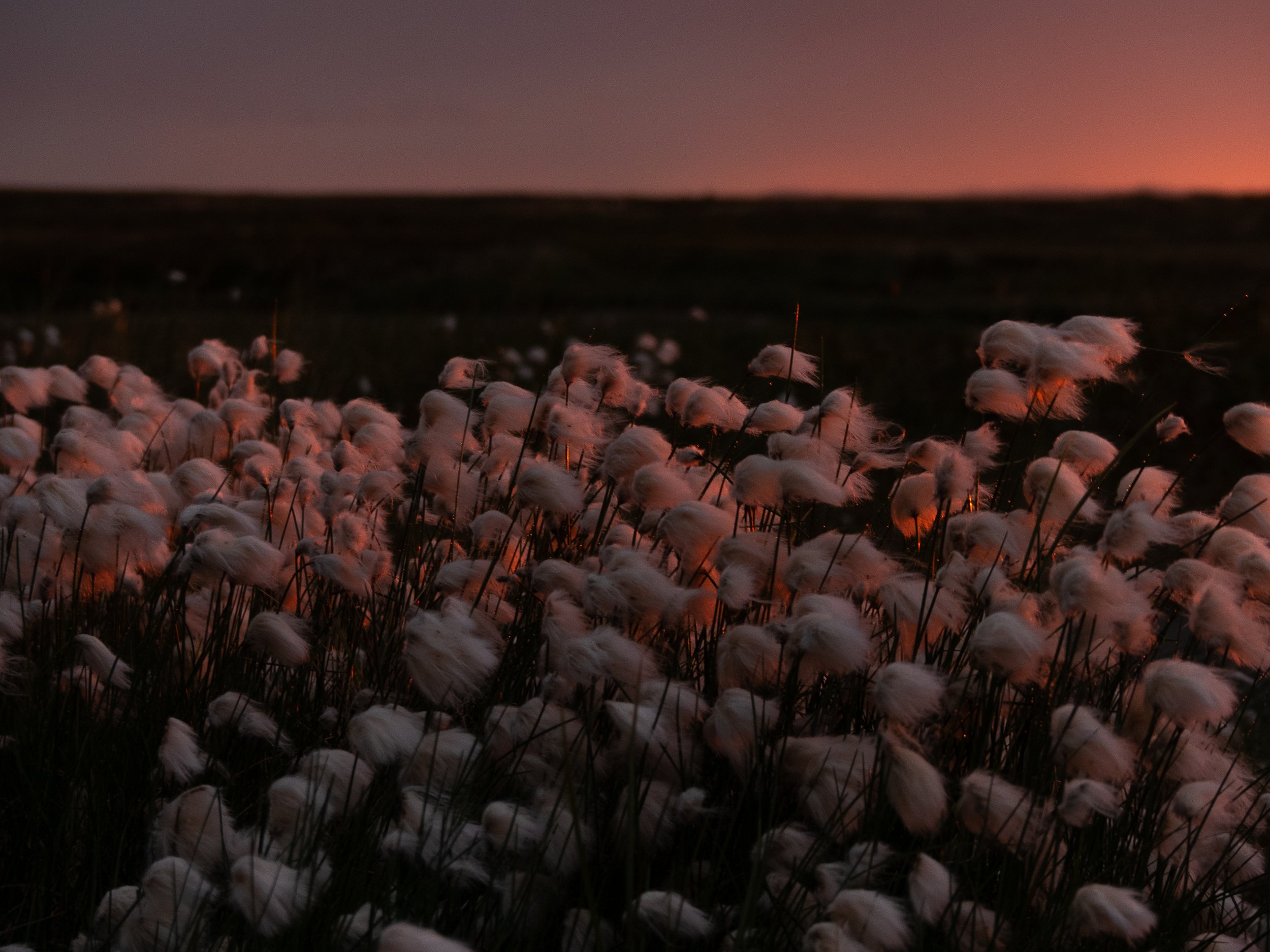


There are several other prominent plant species in the YKD. This is Labrador Tea (Rhododendron tomentosum spp. subarcticum).
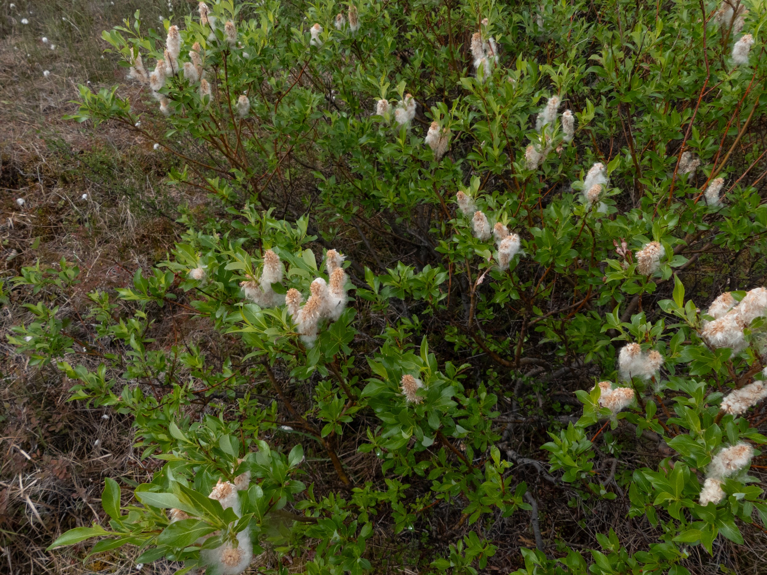
Willow (Salix).

Fireweed (Chamaenerion angustifolium).
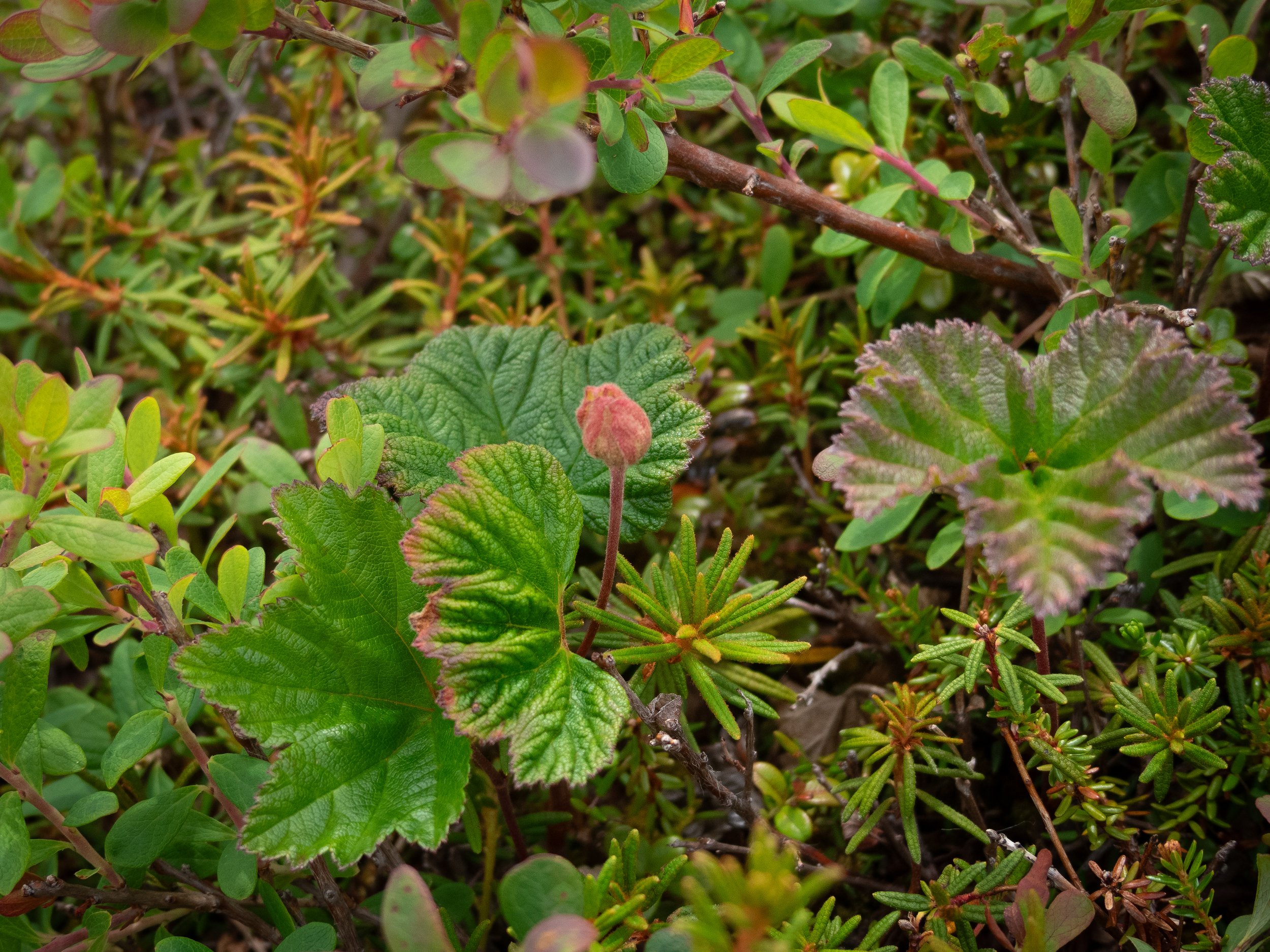
Cloudberry (Rubus chamaemorus), the maple-leafed plant in this photo.
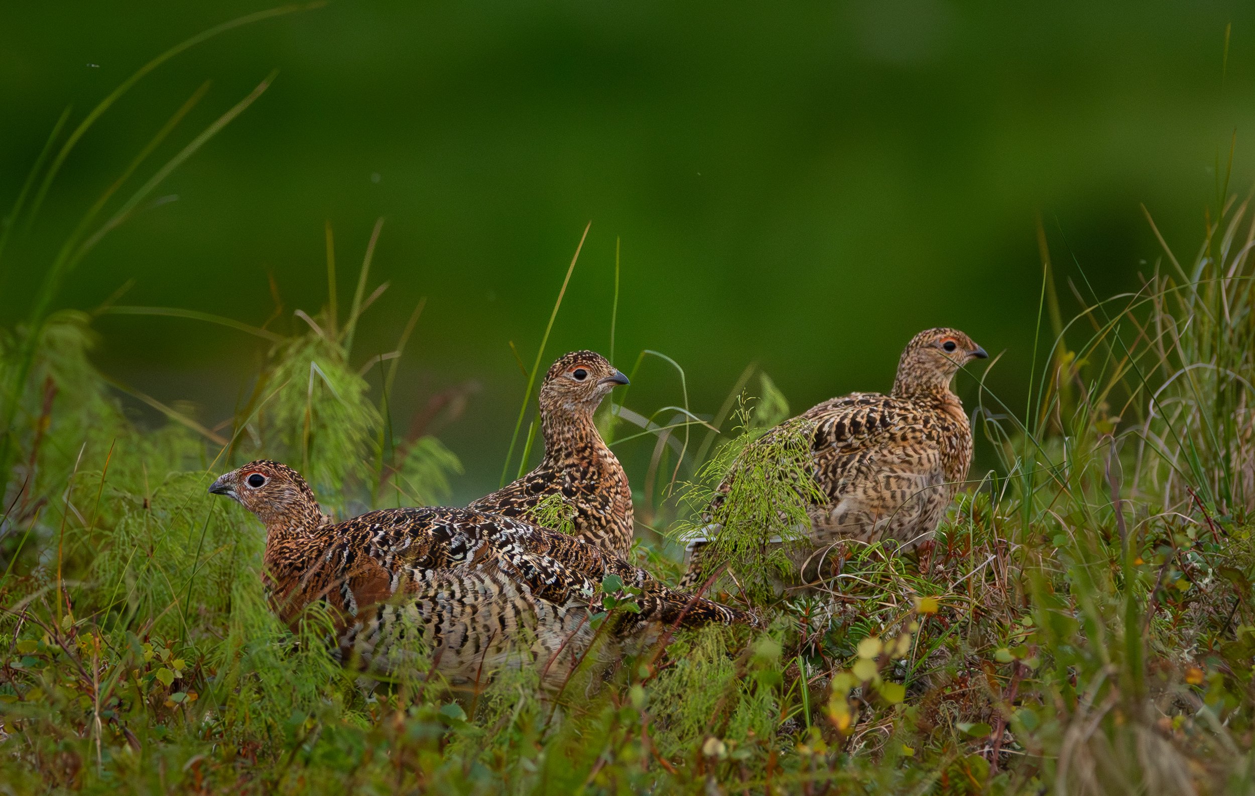
The YKD is full of wildlife. Willow ptarmigan are year-round residents. When startled, they make a clucking sound as they fly.

Beavers are quite new to the YKD, but they've habituated well.
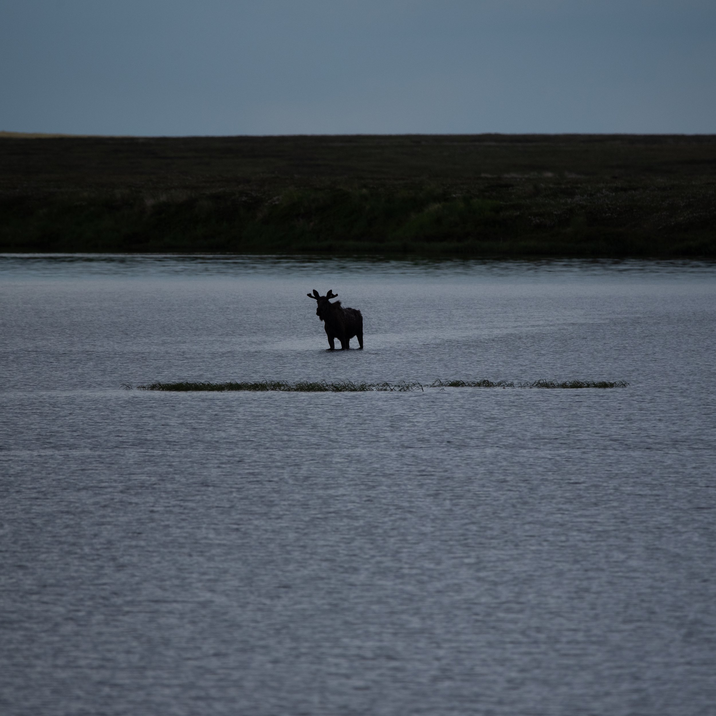
Moose are plentiful. They eat the willows that are abundant in the low-lying areas of the delta.
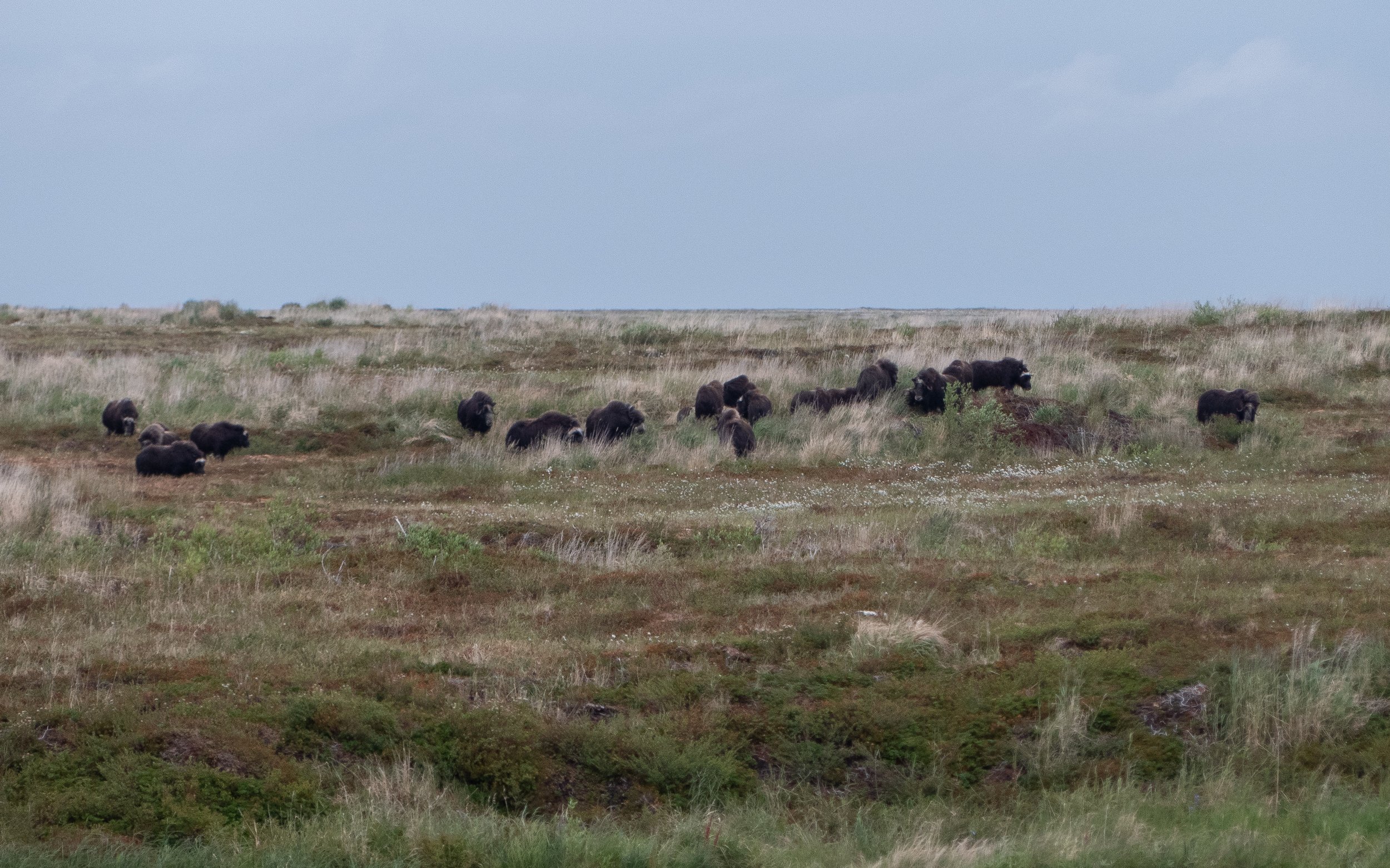
Muskoxen were exterminated from the YKD in the 1920s, but they were reintroduced a decade later from Greenland. Since then, the herds have grown to around 500 individuals.
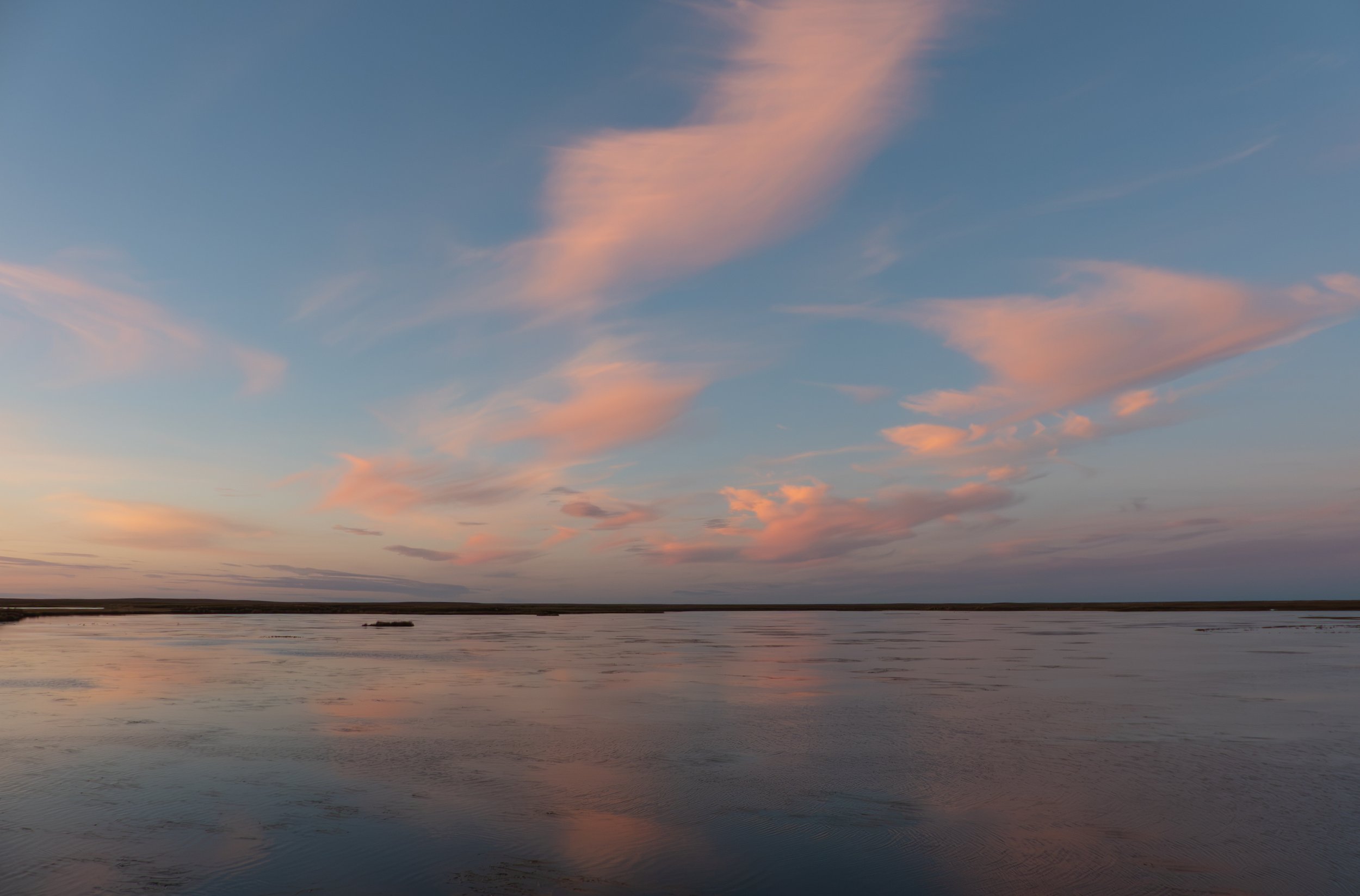
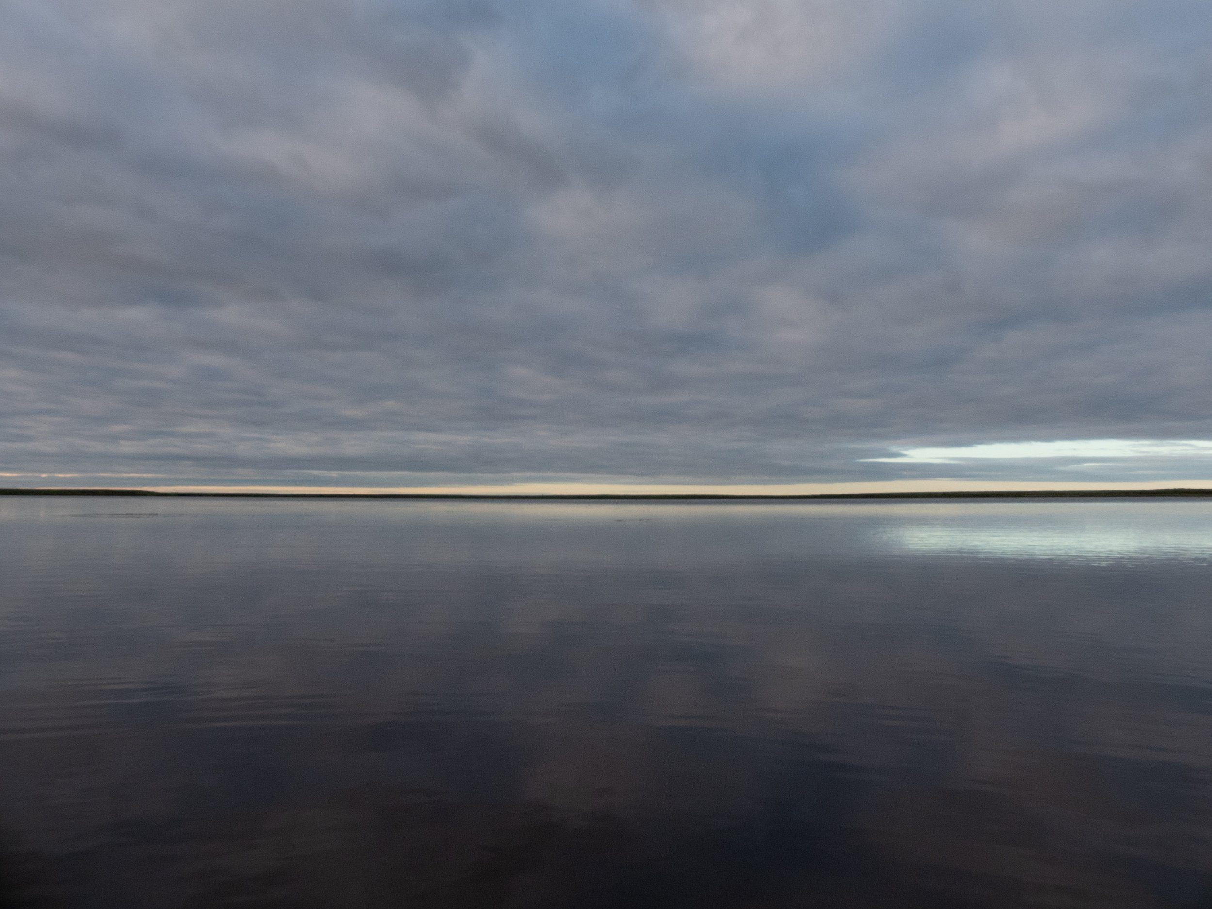
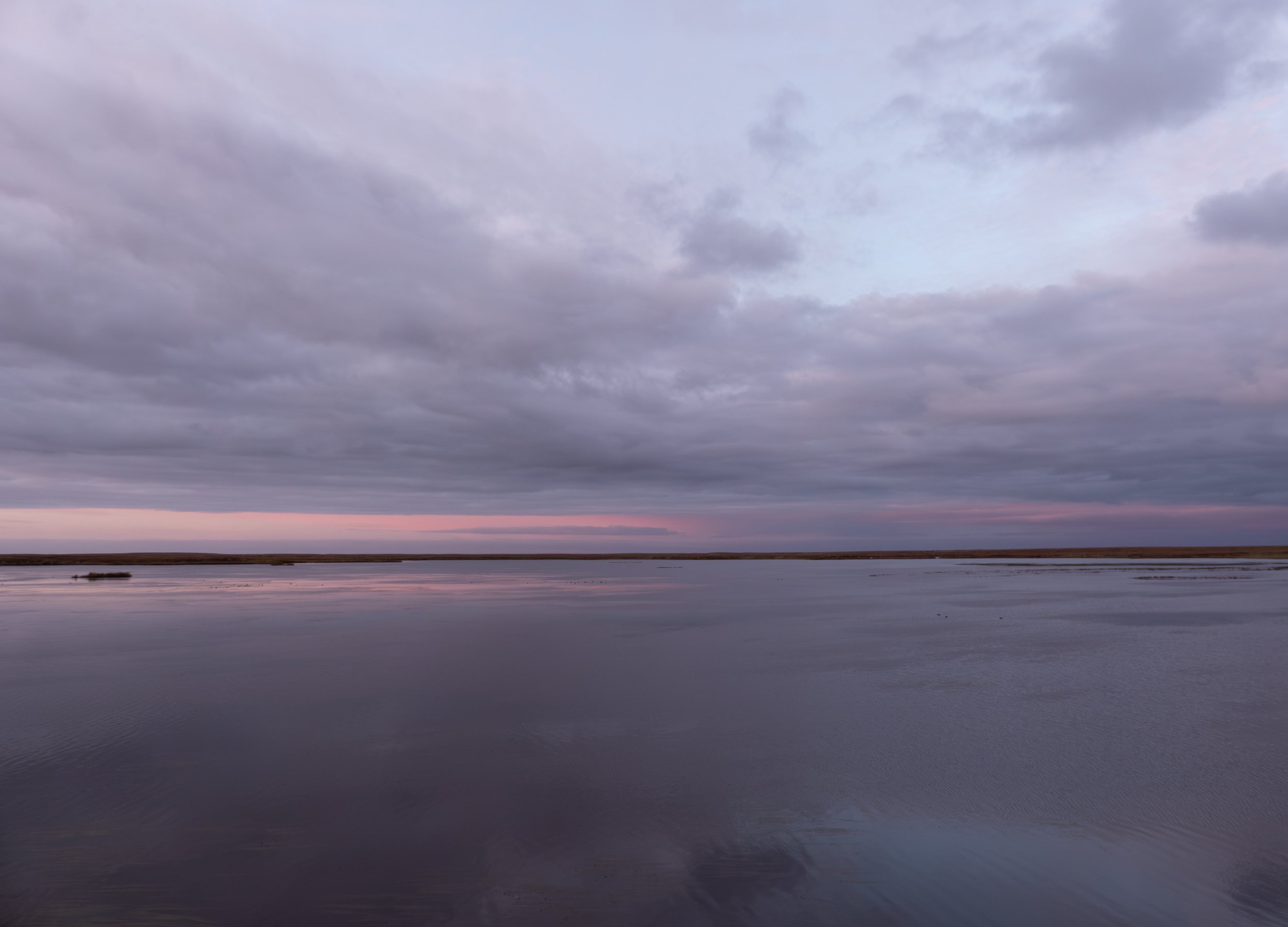
Weather-wise, this was a place of extremes. On one end, there was the extreme beauty of the sky on still days. With such little elevation change and visual interference from tall objects, the sky was a vast spectacle, especially when reflected in the water. I’ve cherry-picked a few of my favorite skies across my many months on the tundra.
The other end of the spectrum, not so lovely. Most days were cold, rainy, and windy. In 2022, two other scientists and I endured extratropical Typhoon Merbok. The videos I’ve included here don’t really do it justice. By the time the storm peaked, we were facing 75-80 mph gusts of wind with no natural windbreaks.

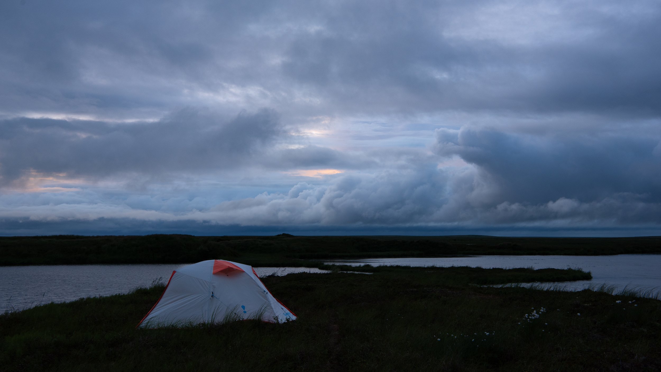
We made camp on this peninsula with very little infrastructure. I slept out of this flimsy three-season camping tent for over 5 months.

A view from the opposite direction. The white tent with the gray cover was our cook tent; the green and white tent was our lab tent, where we prepared materials for our research.

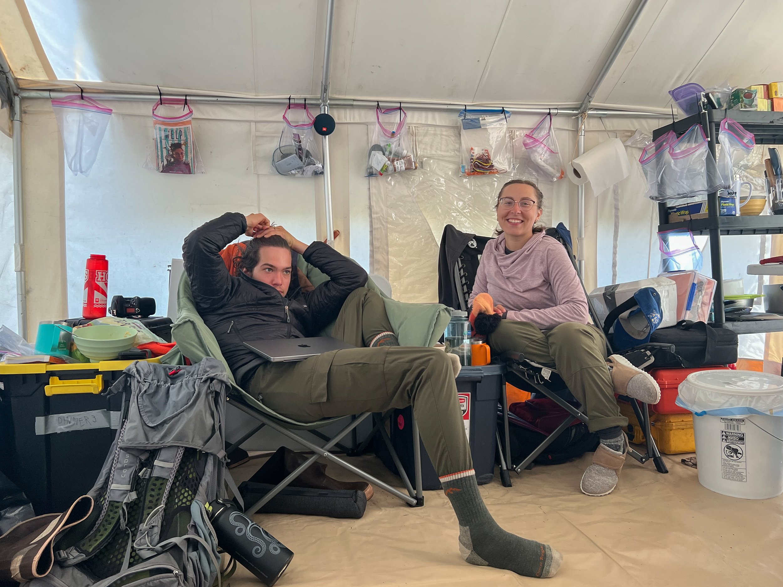
Inside the cook tent. Photo credit: Christina Minions
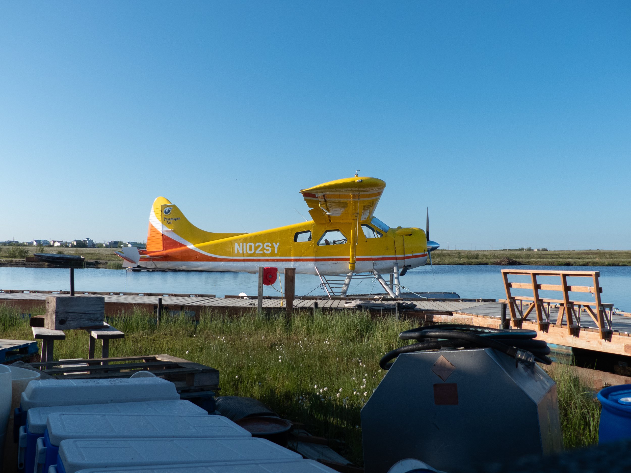
The peninsula was 50 miles northwest of Bethel, Alaska. We chartered several small fixed-wing planes to get us and our supplies there. We stayed there for months at a time, meaning we brought all of our food and scientific equipment on day 1.
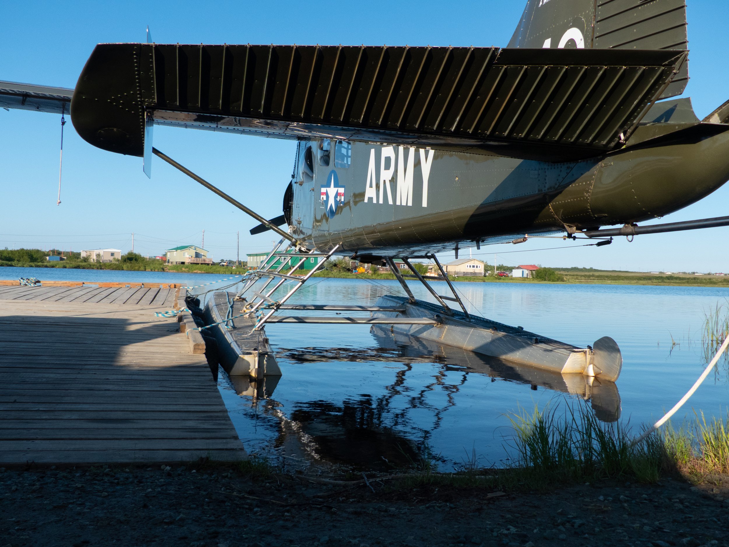
These planes had the capacity to land on water. Part of the reason we chose our location on the tundra was because the lake next to it was large enough to safely land. We named it Landing Lake. We scientists aren't known for our creativity.
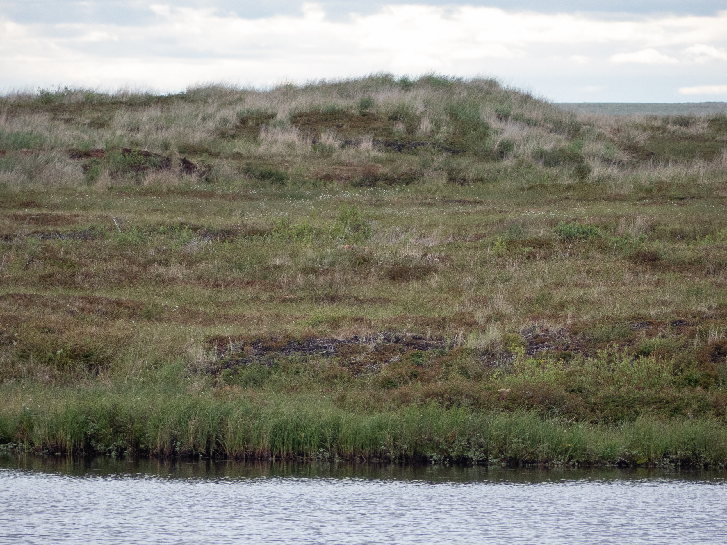
You see that patch of exposed soil near the edge of the water? That's the other reason we chose to live on this particular peninsula. In 2015, this area of the YKD burned alongside 5.1 million acres of land in Alaska. Warming temperatures are leading to more frequent fires on the tundra, as warmer air can hold more moisture, leading to more lightning strikes. Warmer temperatures are also associated with drier conditions on the ground, which gives fires a better chance to ignite and spread. You can read more by clicking on this photo.

The peninsula sits on the edge of the fire scar, so we had equal access to "unburned" areas of tundra (technically, areas that haven't burned in a long time). This was the crux of most of our research. How do unburned areas match up to recently burned areas in terms of photosynthetic activity? What has grown back in the years since the 2015 fire? Is it the same species as the unburned areas in the same proportions? Establishing our base camp at the edge of the fire scar was deeply advantageous to examine these types of comparisons.
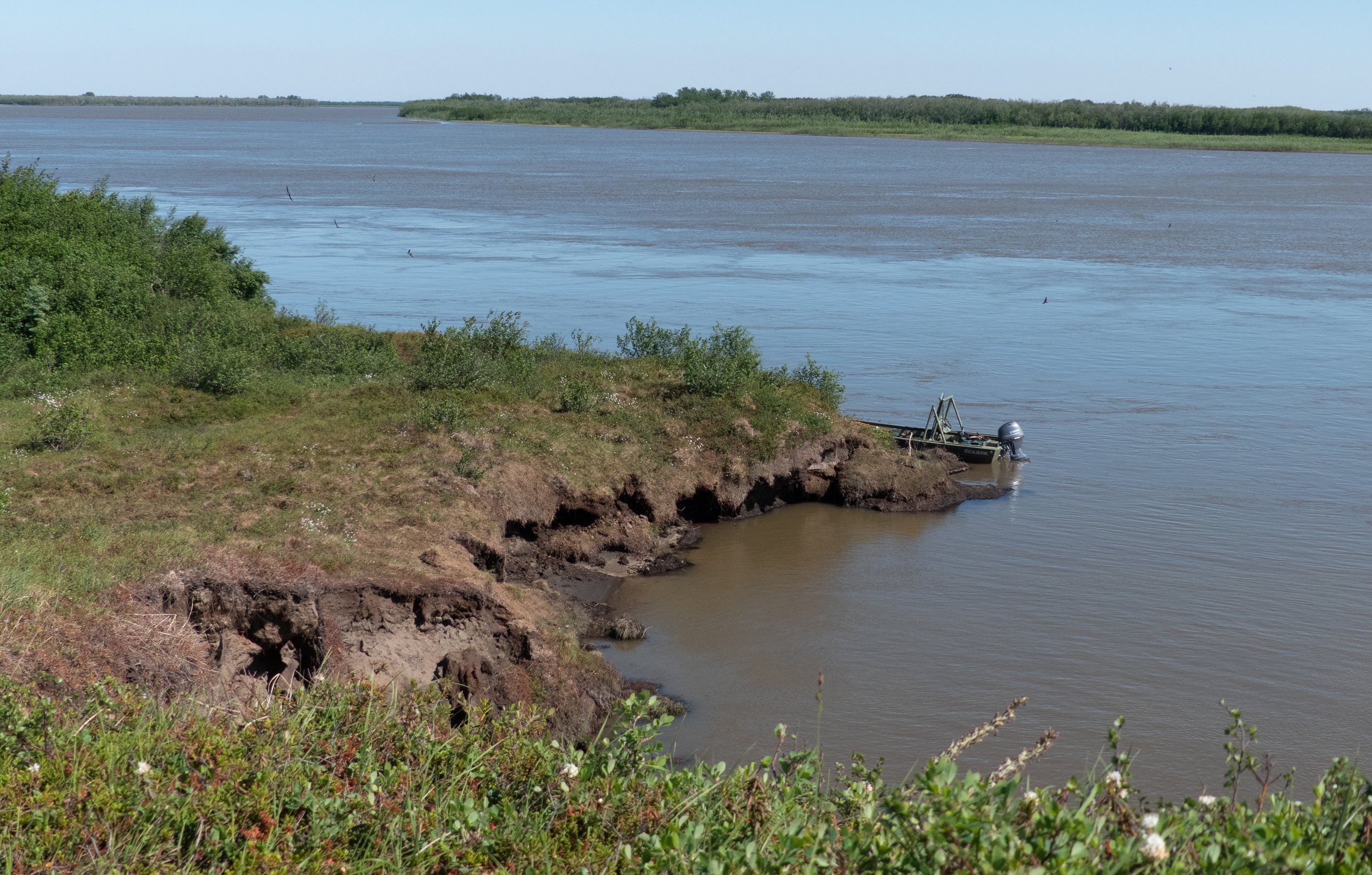
As climate change intensifies, thawing permafrost is one of the largest concerns for the YKD. Permafrost is permanently frozen soil. It is beginning to thaw, and as the frozen layer of soil heats up, bacteria begin to break down the previously frozen plant material, releasing methane into the atmosphere. Methane is a potent greenhouse gas. Given the hundreds of thousands of square miles of tundra, this is a massive concern for future warming scenarios. Also, as permafrost thaws, the ground sinks and erodes if near a water source, as pictured above.
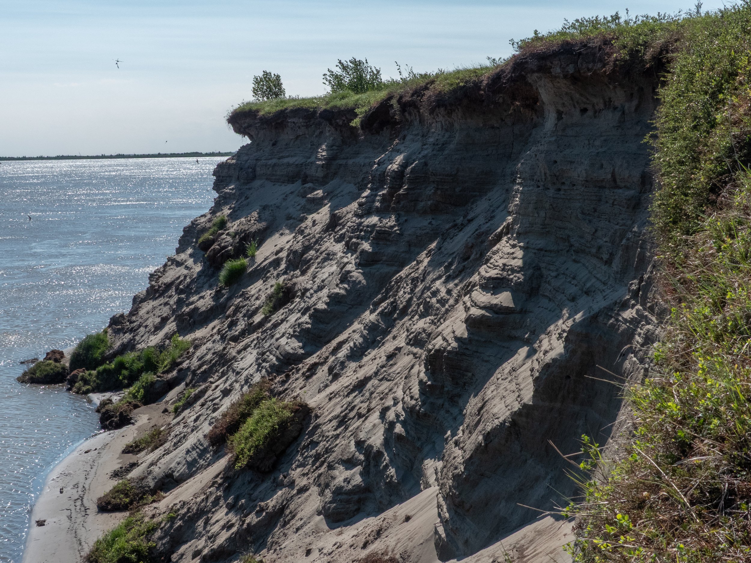
Fires and thawing permafrost are linked through a phenomenon called albedo. Albedo is a measure of how reflective a surface is. When sunlight hits a darker surface, more energy is absorbed into that surface compared to a lighter surface, which reflects more of the energy outward. When a fire burns through an area of tundra, the charred soil is less reflective and can absorb more energy from the sunlight in the form of heat, which further increases the rate of permafrost thaw. In this photo, for example, the darker soil on the exposed cliffside reflects less energy than the green plants.
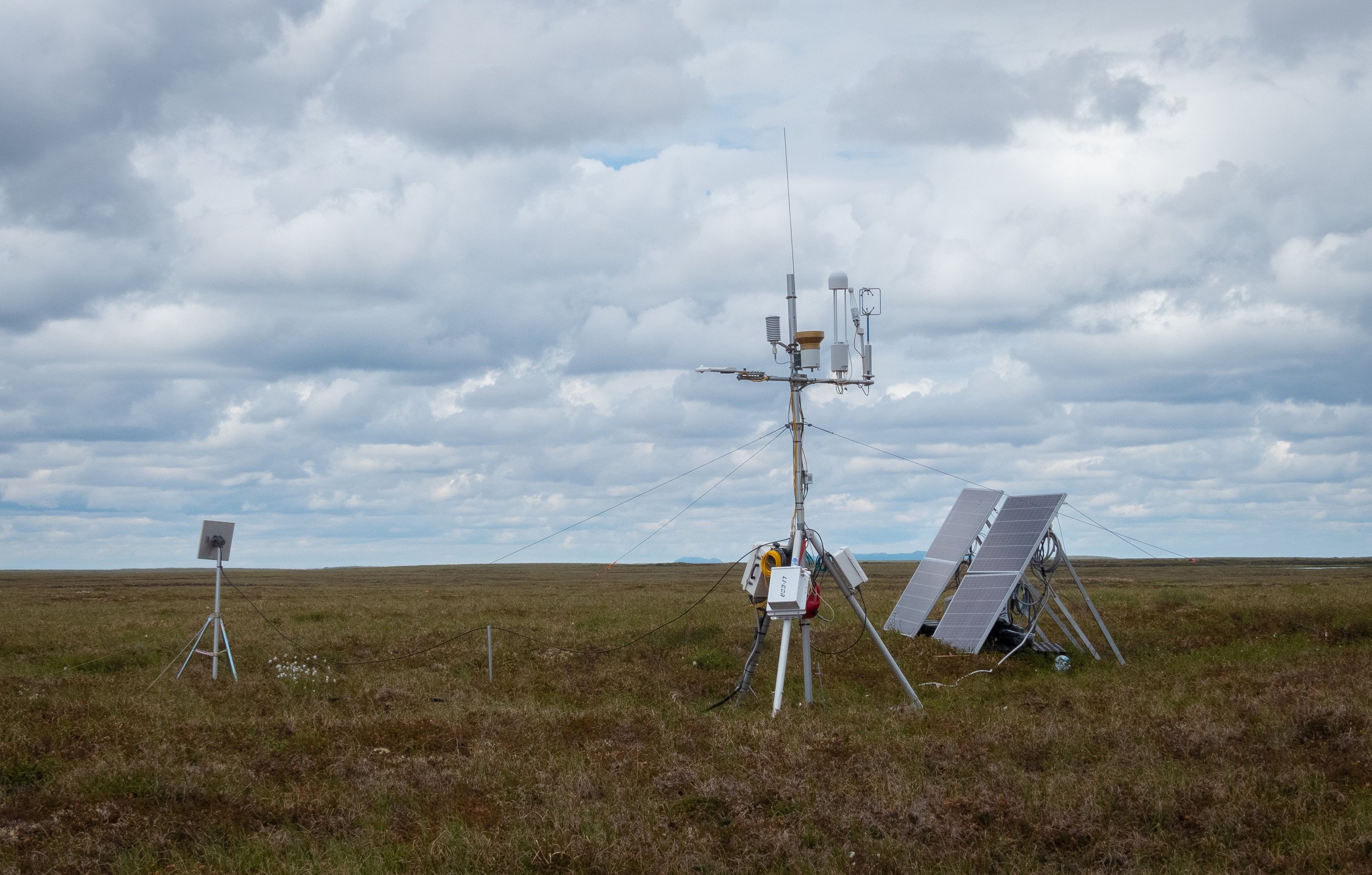
So, how did we compare the burned and unburned areas of the tundra? The ace up our sleeve were our two "eddy covariance flux towers," one of which is pictured here. Flux towers are powerful machines that continuously measure environmental variables, like temperature and the amount of carbon dioxide and methane in the air. One tower can record data over an area about the size of a football field. We placed one tower in the burn scar the other in a nearby unburned location. This is the unburned tower.
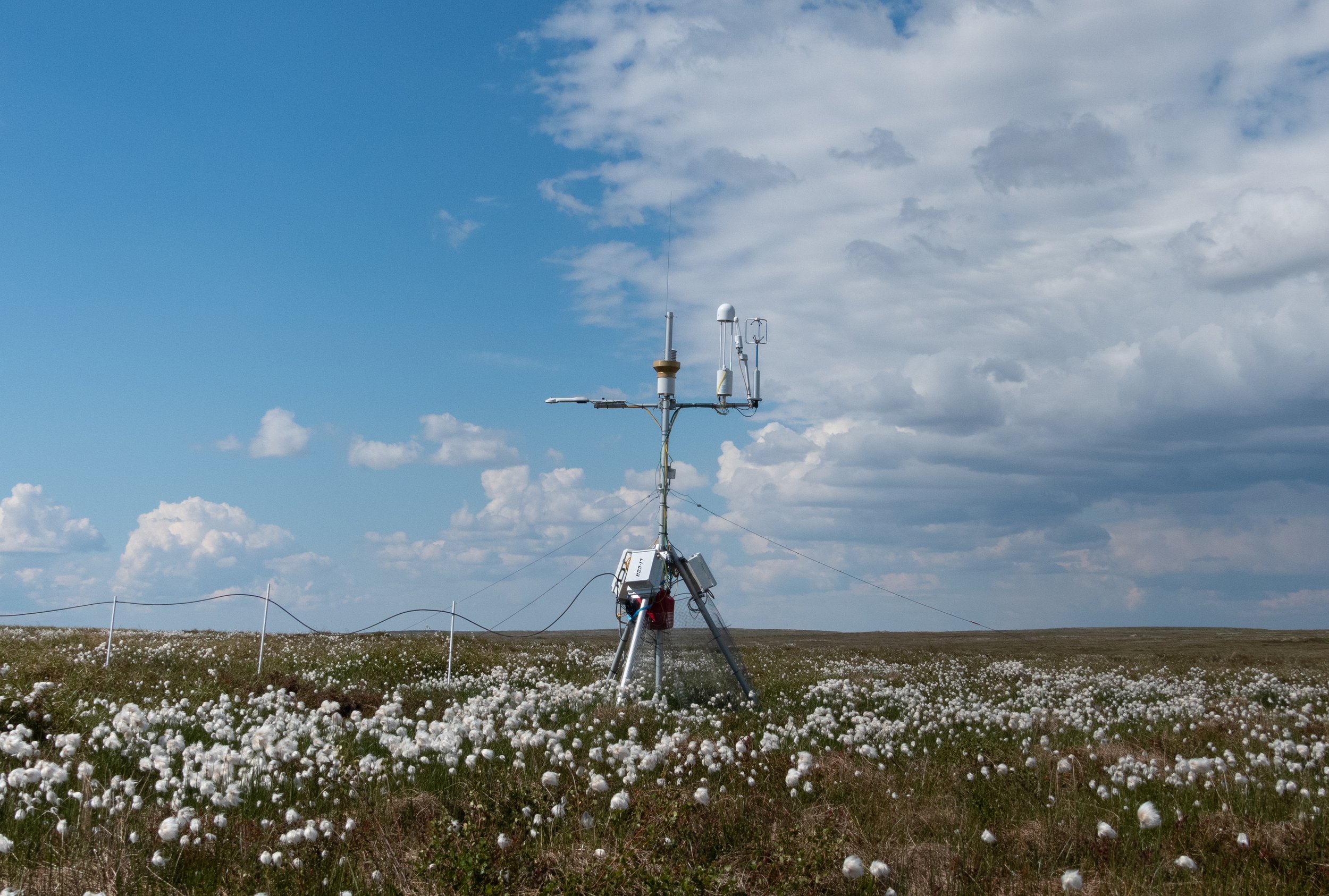
Here is the burned tower. Flux towers play an integral role in understanding how the Arctic responds to climate change. Current climate change models don't adequately include greenhouse gas emissions this area, and these towers are helping to close that data gap, as well as offer a comparison between the burned and unburned areas. They can transmit this data via satellite, which allows for easy access to the data when we're not in the YKD.

That is, if they are working. Flux towers are finnicky instruments and often require our attention. Here, a few coworkers are cleaning the methane gas analyzer, which looks like a small white water tower.
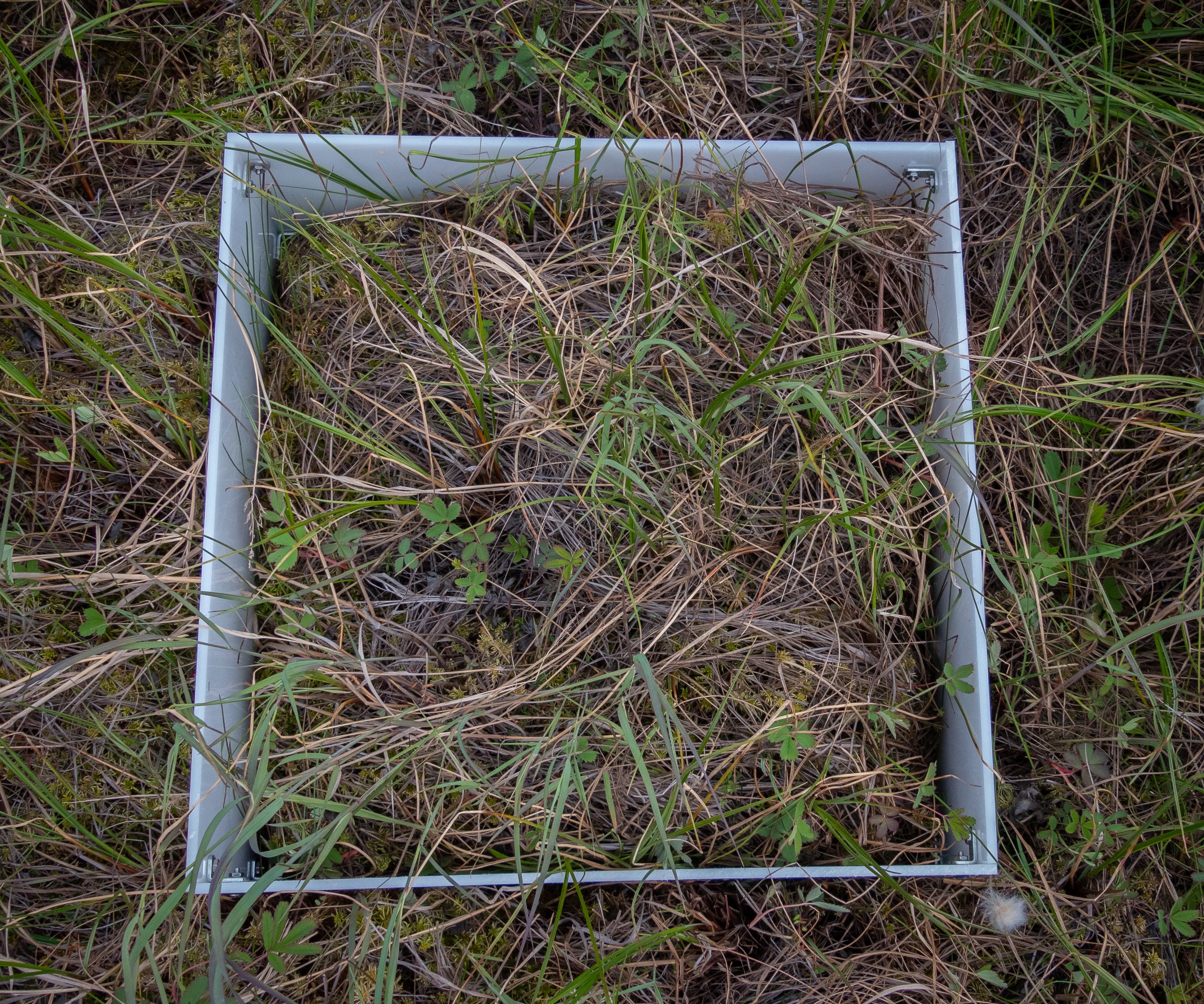
On top of the two flux towers, we also installed these plastic collars into the ground at four other locations at the edge of the 2015 burn boundary. At each location, we installed 3 chambers in the unburned tundra and 3 in the burned tundra.

We placed this clear box on top of the collars to create an airtight seal. The orange box measures carbon dioxide levels inside the clear chamber by pulling and pushing air through the tubes on its side. As plants photosynthesize, they use up the carbon dioxide in the box, and the concentration decreases over time. How fast they decrease tells us about which plants in which areas could pull carbon dioxide faster from the environment. Photo credit: Cameron Gaspord
One of our big findings was that burned areas were more productive (plants in those areas take up more carbon dioxide compared to non-burned plants). We think this is because the soils are warmer due to albedo, which allows for more plant activity. Also, after a burn, there are typically more nutrients within the soil due to the ash deposits, which provide an extra boost for plants regrowing in those areas.
Methane levels didn’t vary as much between burned and unburned sites, which came to me as a surprise. One possibility is that the bacteria that release methane while breaking down plants were somewhat damaged during the fire and haven’t regrown to full strength. It’s also possible that this relationship is governed by factors outside of the experimental design we used. It’s ok to say “I don’t know” after an experiment, and this is one of those cases.
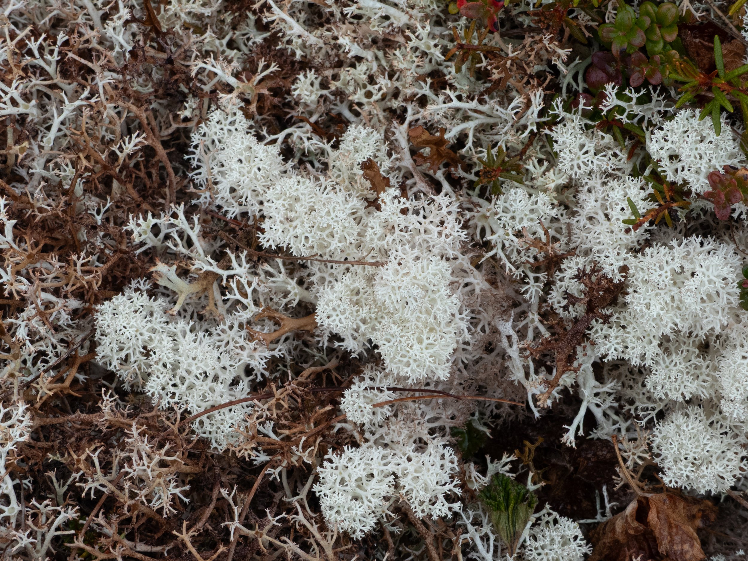
One major implication from fires on the tundra have to do with lichen. There are a variety of lichens that grow in the YKD, but they grow very, very slowly, on the scale of decades to a century. When a fire burns an area, shrubs and grasses vastly outpace lichens when recolonizing that area, changing the species composition in the YKD over time.
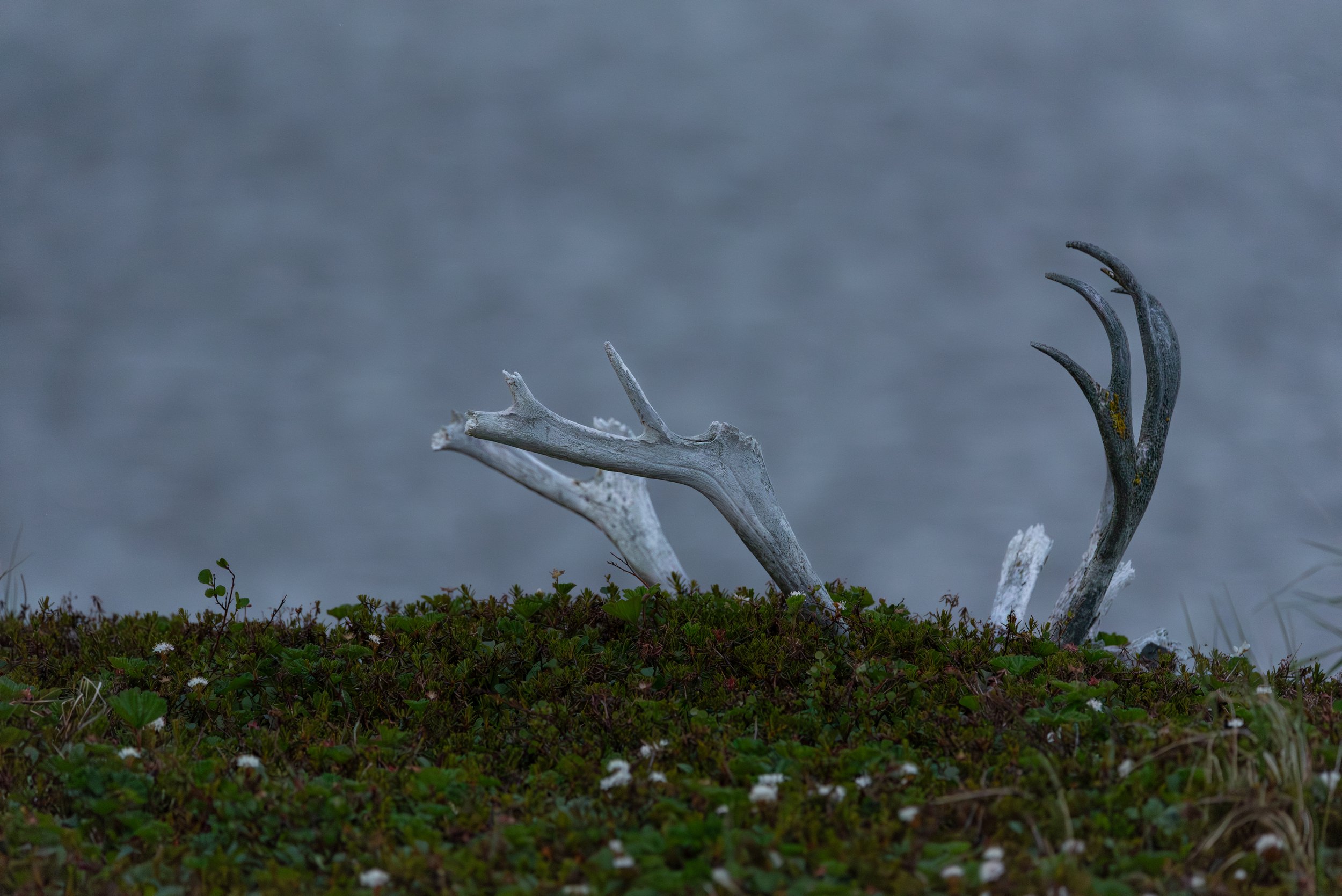
This is a problem, especially for caribou, who eat lichens in the winter months. This caribou skull was on our peninsula, but they no longer visit this area of the YKD. As fires continue to grow in frequency and size, their winter range will become more constrained.
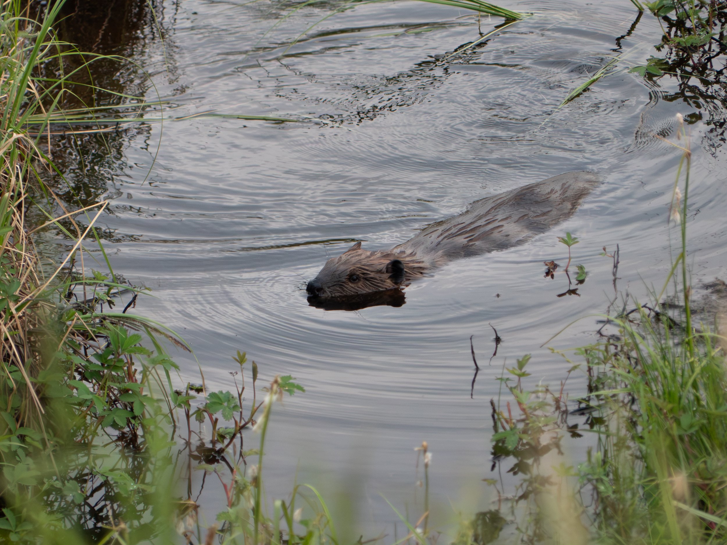
I mentioned earlier that beavers are new inhabitants to the YKD. They are ecosystem engineers, and they are rapidly changing the landscape and hydrology of the YKD by damming rivers.
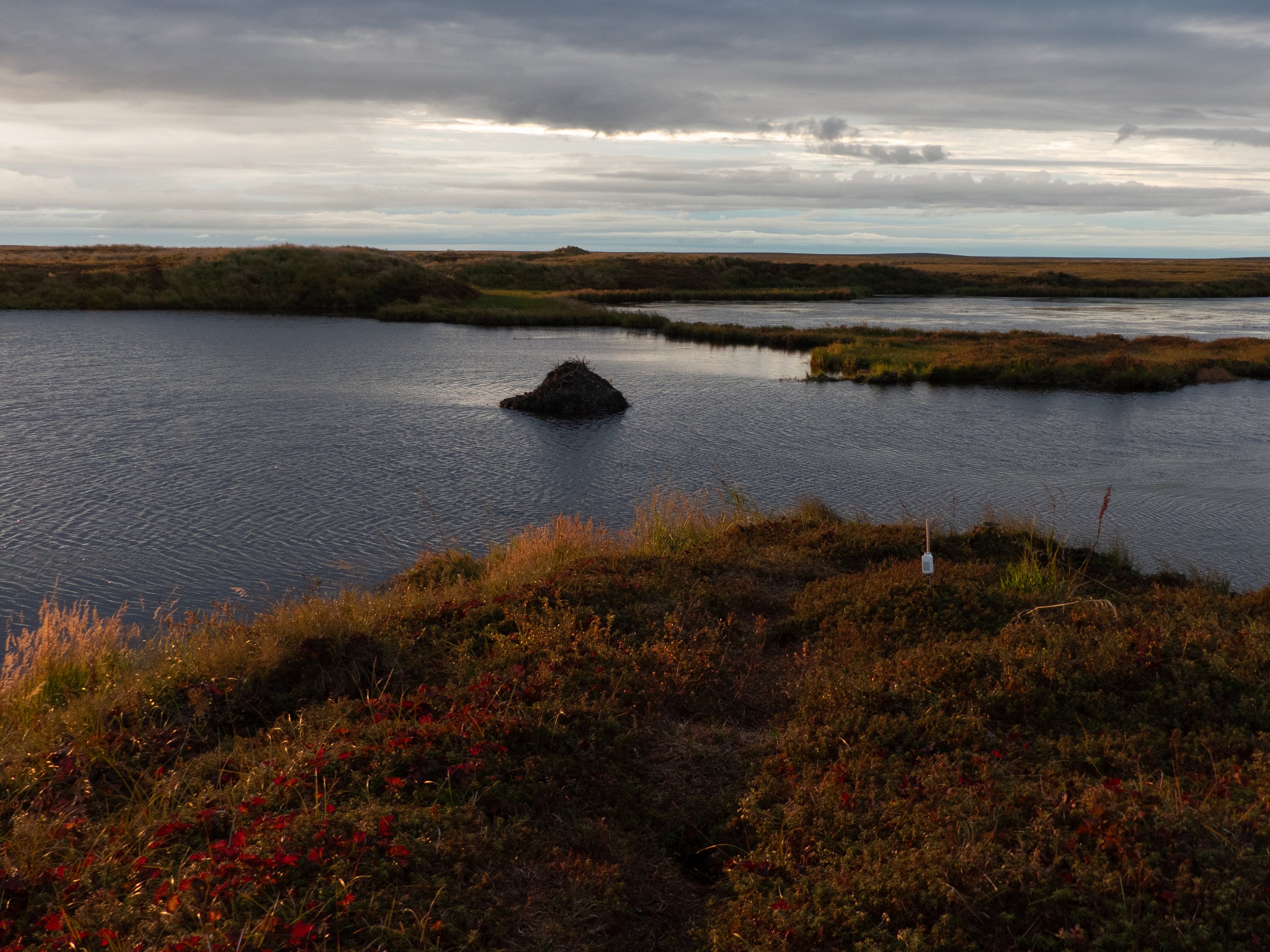
How much they impact the Arctic is still being researched, but their dams seem to accelerate permafrost thaw as the newly standing water warms the surrounding soil.
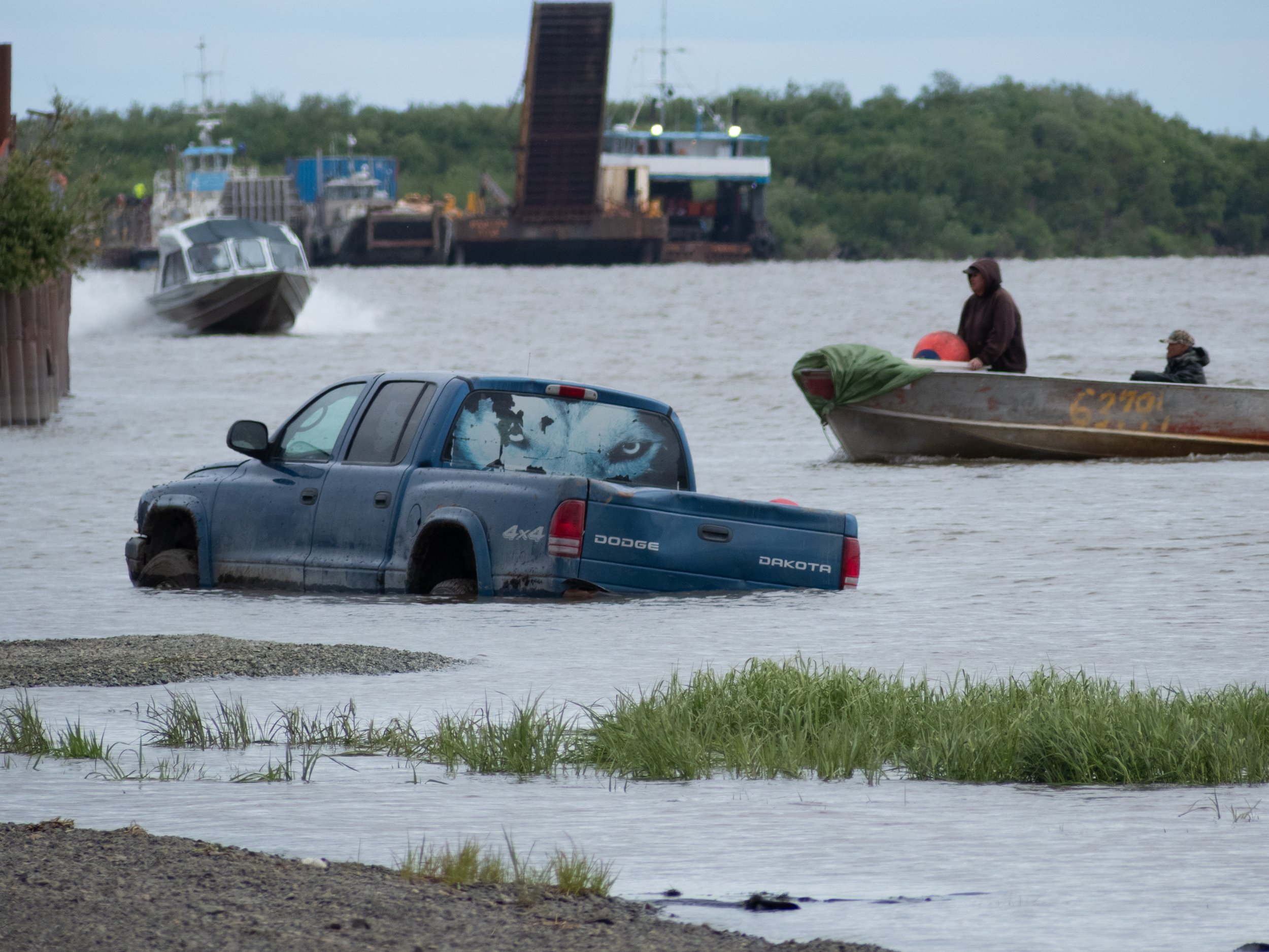
So far, most of this discussion has been limited to the plants and animals I spent my time with in the field camp, but the YKD is also home to 56 Indigenous villages dotted across the tundra. As the permafrost thaws and the land sinks, their infrastructure is at risk of destabilization. Paired with rising sea levels, these communities face an increasing risk of extreme flooding events (the YKD is only 50 - 100 feet above sea level to begin with). Climate change will only exacerbate these issues in the future. Some communities are creating exit strategies, others have relocated already.
If you’re up for some more reading, here are a few articles I found insightful while working on this photo story.
Village relocations: https://www.cbc.ca/news/canada/north/newtok-alaska-destroyed-climate-change-relocation-1.7337088; https://www.theguardian.com/us-news/2025/nov/03/alaska-nunapitchuk-climate-melting-permafrost; https://alaskapublic.org/news/2024-04-22/relocation-of-eroding-alaska-native-village-seen-as-a-test-case
The relationship between caribou, lichen regrowth, and fire: https://research.fs.usda.gov/treesearch/37868
Beavers on the Alaskan tundra: https://www.nature.com/articles/s41598-022-09330-6; https://eos.org/articles/arctic-beavers-advance-north-and-accelerate-permafrost-thaw
The scientific report of the burned vs. unburned research I contributed to: https://iopscience.iop.org/article/10.1088/2515-7620/aeb866